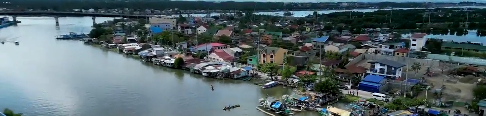

Dagupan City covers a total land area of 40,079,278.93 square meters or about 4,008 hectares (as per City Assessor’s Record). However, the digitized cadastral maps reveal that the sum of the lands within Dagupan’s boundaries is 4,447.10 hectares. It is bounded by the Lingayen Gulf in the north, San Fabian in the northeast, Mangaldan in the east, Calasiao in the south and Binmaley in the west. The city falls with latitude 160 01’ to 160 07’ north and longitude 1200 18’ to 1200 23’ east.
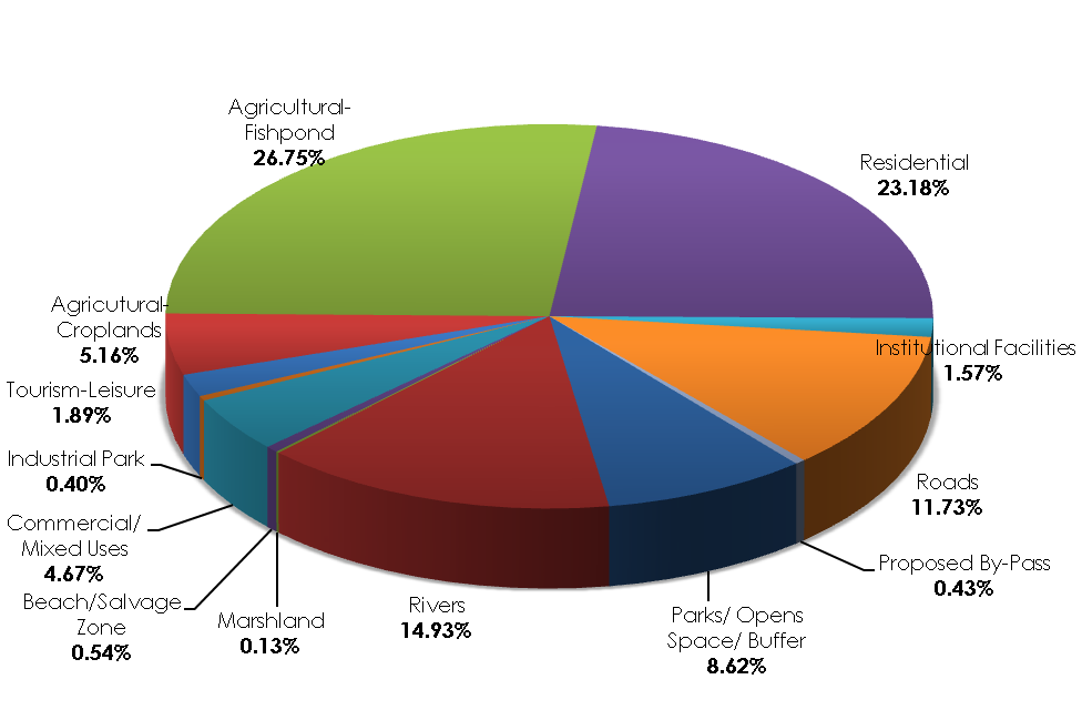
LAND USE ALLOCATION
| LAND USE CATEGORY | AREA (Ha.) | % TO TOTAL LAND AREA |
|---|---|---|
| PROTECTED AREA | 1,077.20 | 24.22 |
| Parks/ Open Space/ Buffer | 383.20 | 8.62 |
| Rivers | 664.00 | 14.93 |
| Marshland | 6.00 | 0.13 |
| Beach/ Salvage Zone | 24.00 | 0.54 |
| PRODUCTION AREA | 1,728.67 | 38.87 |
| Commercial/ Mixed Uses | 208.00 | 4.67 |
| Industrial Park | 17.72 | 0.40 |
| Tourism-Leisure | 84.00 | 1.89 |
| Agricultural-Croplands | 229.41 | 5.16 |
| Agricultural-Fishponds | 1,189.54 | 26.75 |
| SETTLEMENT AREA | 1,030.80 | 23.18 |
| Residential | 1,030.80 | 23.18 |
| INFRASTRUCTURE AREA | 610.43 | 13.73 |
| Social Infrastructure | ||
| Institutional Facilities | 69.80 | 1.57 |
| Transport Infrastructure | ||
| Roads | 521.50 | 11.73 |
| Proposed By-Pass | 19.13 | 0.43 |
| TOTAL | 4,447.10 | 100 |
Source: City Planning and Development Office, As of 2013
Figure 1. Dagupan City Land Use Percentage Share, CY 2013